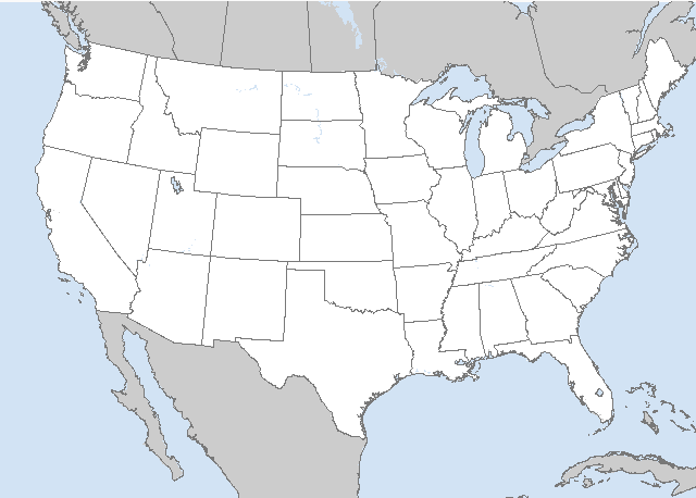
LIVE MAP (ABOVE) ... SPC 0600Z Day 2 Outlook
Day 2 Convective Outlook CORR 1
NWS Storm Prediction Center Norman OK
0112 AM CDT Sun Jun 25 2023
Valid 261200Z - 271200Z
...THERE IS AN ENHANCED RISK OF SEVERE THUNDERSTORMS ACROSS PARTS OF
NORTH CAROLINA AND VIRGINIA...
CORRECTED FOR WORDING
...SUMMARY...
A severe threat is expected to develop on Monday across much of the
Atlantic coastal states. The greatest severe potential is expected
in the Carolinas and Mid Atlantic, where damaging winds and isolated
large hail will be possible. An isolated severe threat will also be
possible in the northern High Plains.
...Atlantic Coastal States...
An unseasonably strong upper-level trough will move eastward into
the southern and central Appalachians on Monday. Ahead of the
system, a moist and unstable airmass will be in place across much of
the Atlantic coastal states. Surface dewpoints in the 60s F, along
with surface heating, will result in a large area of moderate
instability by midday. During the early afternoon, thunderstorms are
expected to form within the higher elevations of the central and
southern Appalachians. These storms are forecast to quickly grow
upscale, moving into the lower elevations of the Piedmont during the
mid to late afternoon. MCS development will be possible as storms
congeal into an organized line segment during the late afternoon and
early evening.
The instability axis is forecast to be located near a pre-frontal
trough in the lee of the Appalachians around midday. A consensus of
model forecasts suggests the greatest instability will develop from
central North Carolina into southern and central Virginia, where
MLCAPE values appear likely to reach the 2000 to 3000 J/kg range. In
addition to moderate instability, NAM forecast soundings near
Richmond, Virginia and Raleigh, North Carolina have steep mid-level
lapse rates with relatively cool temperatures aloft. This, combined
with 0-6 km shear in the 30 to 35 knot range will likely support
supercell development. The potential for supercells will be greatest
early in the afternoon, before storms merge into a line. Hailstones
of greater than 2 inches in diameter will be possible with
supercells that develop in areas that destabilize the most. The
current thinking is that a relatively quick transition to a line
will occur. This line is forecast to become organized, moving
eastward across the Piedmont into the Raleigh/Durham and Richmond
areas during the late afternoon. Wind-damage will be likely along
the leading edge of the stronger parts of this line segment.
The severe threat is likely to extend further north into the
Mid-Atlantic, and possibly as far north as southern New England.
However, instability is not forecast to be as strong further to the
north, suggesting that the threat should be more isolated.
...Northern High Plains...
An upper-level ridge is forecast to move across the central and
northern High Plains on Monday. Beneath the ridge, a narrow corridor
of moderate instability is forecast to develop by afternoon. Surface
winds will likely be backed to the east from western South Dakota
eastward across much of northern Wyoming, helping to maintain a
moist airmass across the northern High Plains. Thunderstorms will
develop during the mid to late afternoon in areas that heat up the
most. Steep mid-level lapse rates and moderate deep-layer shear will
support an isolated severe threat. A few of the stronger cells could
produce hail and marginally severe wind gusts.
..Broyles.. 06/25/2023
Read more CHECK UPDATE ZOOM GRAPHIC
http://dlvr.it/SrBndq
Windy.com Temps | Gusts | WU KORD KPWK |
CLICK for this month's BIG night sky ... | RADAR FULL MAP SCREEN |
|---|
MOBILE DEVICE? Turn sideways. Weather conditions directly above are near Lakefront. Top tabs refer to O'Hare (official).
Archives for the SPC Convective Outlook are updated daily (approximately) with a live map at the beginning of each article. Follow the link at the end of the article to check for current updates on the NOAA/NWS Storm Prediction Center website. Also, see Archives for Chicago's hourly weather data on CARDINAL NEWS Magazine.
CONVECTIVE | TORNADO | WIND | HAIL
O'Hare International Airport KORD
(Arlington Heights South)
Chicago Executive Airport KPWK
(Arlington Heights North)
Sunday, June 25, 2023
SPC Jun 25, 2023 0600 UTC Day 2 Convective Outlook
SUNRISE AND SUNSET TIMES IN UTC (if you're not logged in to Google)
CHICAGO UTC-6 during CST (Central Standard Time, e.g., winter)
CHICAGO UTC-5 during CDT (Daylight Savings Time, e.g., summer)
CHICAGO UTC-6 during CST (Central Standard Time, e.g., winter)
CHICAGO UTC-5 during CDT (Daylight Savings Time, e.g., summer)


