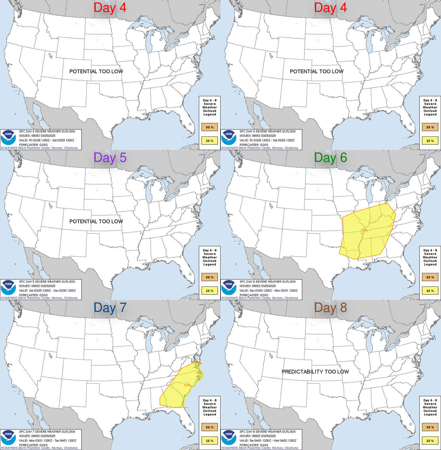
LIVE MAP (ABOVE) ... Day 4-8 Outlook
Day 4-8 Convective Outlook
NWS Storm Prediction Center Norman OK
0341 AM CDT Sun May 14 2023
Valid 171200Z - 221200Z
...DISCUSSION...
Latest runs of the medium-range models suggest that the overall flow
pattern over the U.S. featuring a western ridge and an eastern
trough will persist through the end of the period. As such, with
the higher low-level theta-e airmass largely suppressed southward
through the period, severe threat appears likely to remain generally
limited.
Day 4 (Wednesday), a cold front -- already off the Atlantic Coast --
is progged to sag southward across the Gulf Coast states. While
showers and thunderstorms will likely accompany the progressing
front, generally weak flow aloft will limit potential for organized
storms.
While this front lingers in the vicinity of the Gulf Coast, an upper
low is forecast to shift southeastward out of the Canadian Prairie
and into the Upper Great Lakes Day 5, and then to the Lower
Lakes/Upper Ohio Valley region Day 6. As this low advances, an
accompanying surface cold front is progged to shift southeastward
across the Midwest and southward across the Plains. With the higher
theta-e airmass remaining suppressed to the south by the
prior/lingering front, moisture/instability should remain limited
ahead of this next front Day 5, with severe threat likely to remain
limited.
As the front sags farther south into the southern Plains, and across
the Ohio Valley Day 6, increasing proximity to greater low-level
moisture should result in more substantial instability ahead of the
front. This suggests some increase in severe risk, though still
likely limited in most areas due to modest flow and persistence of
weak short-wave ridging across the southern Plains.
Day 7 the front is forecast to continue southward across the Gulf
Coast region and into the Gulf, and eastward toward/into the western
Atlantic. Likelihood for a continued lack of robust
moisture/instability ahead of the front as it reaches the Atlantic
Coast states, and shear which should remain somewhat subdued farther
south, continues to suggest limited severe risk.
With the front likely moving off of both the Atlantic and Gulf Coast
states Day 8, little severe risk is evident.
Read more CHECK UPDATE ZOOM GRAPHIC
http://dlvr.it/Sp1V4N
Windy.com Temps | Gusts | WU KORD KPWK |
CLICK for this month's BIG night sky ... | RADAR FULL MAP SCREEN |
|---|
MOBILE DEVICE? Turn sideways. Weather conditions directly above are near Lakefront. Top tabs refer to O'Hare (official).
Archives for the SPC Convective Outlook are updated daily (approximately) with a live map at the beginning of each article. Follow the link at the end of the article to check for current updates on the NOAA/NWS Storm Prediction Center website. Also, see Archives for Chicago's hourly weather data on CARDINAL NEWS Magazine.
CONVECTIVE | TORNADO | WIND | HAIL
O'Hare International Airport KORD
(Arlington Heights South)
Chicago Executive Airport KPWK
(Arlington Heights North)
Sunday, May 14, 2023
SPC May 14, 2023 Day 4-8 Severe Weather Outlook
SUNRISE AND SUNSET TIMES IN UTC (if you're not logged in to Google)
CHICAGO UTC-6 during CST (Central Standard Time, e.g., winter)
CHICAGO UTC-5 during CDT (Daylight Savings Time, e.g., summer)
CHICAGO UTC-6 during CST (Central Standard Time, e.g., winter)
CHICAGO UTC-5 during CDT (Daylight Savings Time, e.g., summer)


